About Trigpointing Ireland
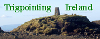
In the summer of 2006 I started walking in the hills around Belfast to get some exercise. I soon discovered that some of the summits had concrete structures on them and upon investigation, learned that they were Triangulation Pillars. I started logging my visits to these sites on a website, but quickly discovered that it was based on the British Grid and did not fully support Ireland.
Trigpointing Ireland was created in November 2006 to fill that gap. I had no idea if anybody else in Ireland was interested but I was content to use the site as a sort on online diary for myself. Originally I was only interested in TPs on hills but decided that I would visit as many as possible, just for the sake of completeness. I added a facility to allow others to register so that they could upload condition reports and photographs.
The database and maps were all updated manually on my PC. I then had to created up to date lists and map images and upload them to the site. As more people got involved, it became increasingly difficult for me to do this so I upgraded the server to include online database faclilites and proceeded to learn how to use them. Many of the pages now contain dynamic data. For example, the statistics, Map and recent reports list on the fron page all update automatically as more people register, as new reports are received and as new records are added to the database.
The growing membership has wider interests than I, and requests were made to include OS marks other than TPs. In February 2008, this support was added to the site.
OS Marks Currently Supported
| Abbreviation | Type |
| PTP | Primary Triangulation Pillar |
| TP | Triangulation Pillar |
| NPFB | Non PillarFlush Bracket |
| BM | Bench Mark other than a FB |
| PGPS | Passive GPS Station |
| BT | Base Tower |
We are still a relatively small band, but I am encouraged enough to continue developing the site. Why not register so that you can contribute to our knowledge base and have a say in what the site provides.
James Carroll